Impact of heat on cities explored in new report
A new AI-powered model that provides a more detailed picture of how heat is experienced in cities has been developed by researchers at the University of Illinois Urbana-Champaign.

A new AI-powered model that provides a more detailed picture of how heat is experienced in cities has been developed by researchers at the University of Illinois Urbana-Champaign.

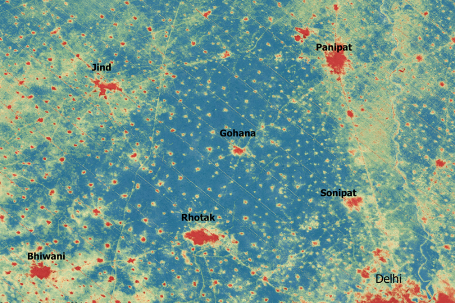
With cities often described as ‘heat islands’, the researchers sought to determine a more accurate representation of the temperatures that city dwellers are forced to deal with on hot days, suggesting that commonly used satellite measurements may overstate differences in urban temperatures.

“Yes, cities are hot, and some neighbourhoods are hotter than others,” commented University of Illinois Urbana-Champaign civil and environmental engineering professor Lei Zhao, who led the study. “But not always as extreme as some surface-temperature-based maps suggest.”

Urban High-Resolution Air Temperature dataset

Published in Nature Communications, the study introduces the Urban High-Resolution Air Temperature (U-HAT) dataset, which estimates near-surface air temperatures across more than 380 cities in the US.

According to the researchers, this data set provides more detailed maps of air temperature across cities – on a ‘block by block’ basis – which in turn can be used for public health studies, urban climate research, energy planning and machine-learning applications.

“This data allows for pixel-by-pixel comparison between satellite land surface temperature and true urban air temperature,” Zhao added. “It shows that satellite-based data often overestimates heat stress and exaggerates disparities between neighbourhoods, helping explain why some past maps and media stories may have unintentionally misled the public about how extreme urban heat differences really are.”

Weather monitoring

The researchers also said that this modelling approach could be applied in cities and regions with limited weather monitoring networks, through integrating existing observations with artificial intelligence to ‘fill in’ missing data.

“Many regions, particularly in the Global South, are highly vulnerable to climate change and extreme heat and lack dense networks of weather stations,” Zhao said. “These are often the very places that most need reliable climate and weather information for planning, health and development decisions.”

Other researchers on the study, Transfer learning reveals large discrepancies between air and land surface temperatures in cities, included Illinois graduate student Yiwen Zhang and Pierre Gentine at Columbia University. Read more here and here.

Discover more from Sustainability Online

Subscribe now to keep reading and get access to the full archive.

Continue reading