Op-ed by Maksym Sushchuk, EOS Data Analytics.
Long-lasting environmental problems need well-informed and repeatable action, not more alarm. Consistent satellite records let us spot slow declines, seasonal patterns, and changes that risk becoming large problems. Local managers and activists can already use this information to take actions that have an outsized effect.
Landsat imagery available on EOSDA LandViewer puts satellite records in usable form: decades-long archives, quick comparisons, and analytical tools highlighting trends without months of data work. That enables quicker decisions for scientists, managers, and watchdogs seeking evidence that their efforts make a positive impact.
Major sustainability challenges
Today’s most urgent environmental issues can be expressed in plain numbers. And, unfortunately, these numbers keep climbing:
- Methane from farming. Intensive livestock production, rice farming, and burning residues, among other agricultural activities, generate 46% of global methane, a gas with powerful warming potential.
- Waste in aquatic ecosystems. Around 80% of industrial waste ends up in soil and aquatic ecosystems, killing habitats and polluting food chains.
- Loss of forests. Clearing forests adds 12–20% of yearly greenhouse gases while removing natural carbon sinks.
- Food demand. With global demand potentially rising by 35% by 2030, pressure on farmland and resources will only increase.
These numbers remind us what is at stake and where action matters most. The next step is understanding what actions are needed.
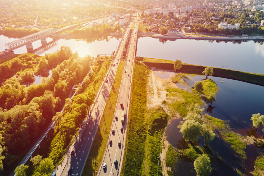
Landsat satellite imagery for tracking land use
Sustainable development today means that we need to put out fires already raging while at the same time building firebreaks to stop the next ones. But where can scientists, activists, or communities with tight budgets find the kind of data these actions demand?
Decades of Landsat satellite images, regularly updated and freely available on analytical platforms like EOSDA LandViewer, are a great source to begin with.
For more than five decades, Landsat satellites have provided consistent imagery of the planet. Unlike early MSS (Multispectral Sensors), today’s TM (Thematic Mapper) records through more bands and finer resolution, suitable for land-use planning and detailed environmental analysis.
A single image covers thousands of square kilometres, enough to show regional patterns of farming, urban growth, or forest change. Landsat imagery can show how farmland expands to meet food demand or track livestock areas and rice fields that contribute to methane emissions. Forest loss, whether rapid clearance or subtle decline, can be mapped year by year. Satellite images also help monitor industrial impacts on rivers, wetlands, and coastal zones. And these are only the most obvious applications.
Monitoring land and sea changes
What’s happening with the land, water, or temperature isn’t always easy to spot from the ground. But satellites do this at scales that ground-based methods can’t. Modern systems use optical, radar, and thermal sensors to map shoreline positions, detect millimetre-level ground shifts, and assess water quality parameters such as turbidity or sediment load.
Archives such as Sentinel, SPOT, and Landsat data allow comparison of decades of change. Analysts process this data in GIS platforms like ArcGIS or QGIS, where shoreline extraction algorithms (using specific band ratios or MNDWI) identify land-water boundaries with about 90% accuracy depending on the reference dataset and local conditions.
Time-series analysis then quantifies erosion through methods like End Point Rate or Linear Regression Rate. These outputs highlight vulnerable coastal zones, guide adaptation strategies, and support marine resource management.
Monitoring environmental change through Earth Observation
Earth Observation creates a wide-angle view of environmental change. Some areas are out of reach for regular ground checks, but satellites can still show what’s happening with the land, climate, and ecosystems there. This helps users monitor ecosystems, assess human impact, and identify risks early.
Historical Landsat 8 data shows patterns like deforestation or glacier retreat, supporting climate studies, policy planning, and sustainability reporting. Earth Observation also reveals changes near industrial or infrastructure sites (e.g., drying wetlands or shrinking tree cover), providing independent evidence for environmental assessments.
Whether used in agriculture, energy, conservation, or urban planning, Earth Observation enables regular updates that make environmental monitoring more visible, consistent, and easier to act on.
Monitoring maritime risks
In 2024 alone, 146 maritime crimes were reported worldwide. Most of them happen far from shore, where patrols can’t reach. But satellites can easily detect unlicensed fishing and vessels that ‘go dark’.
Using radar satellites and global AIS signals, analysts can monitor ship movements in real time, even in poor weather or at night. Suspicious patterns, like loitering or sudden signal loss, are flagged for review.
Platforms combining satellite imagery with RF sensors allow users to manage port traffic, track fleets, and spot unregistered vessels. This helps governments, NGOs, and maritime authorities respond faster and reduce harm to marine ecosystems.
Satellite data is now available to everyone. What actually matters is how it’s used. The more precisely we apply it, the more effectively we can respond to the environmental challenges of today and tomorrow.
About the author
With over fifteen years of experience in commercial writing and journalism, Maksym Sushchuk is dedicated to fostering positive change in society, ecology and the environment. His passion lies in using compelling narratives to inspire action and drive sustainable impact, aiming to create a greener, more resilient world through the art of storytelling.
Learn more about EOS Data Analytics here.